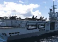


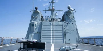


The Norwegian micro surveillance satellite Norsat-3, will be launched from French Guiana in South America this autumn. The satellite will provide key support to the Coast Guard and for crisis management, national broadcaster NRK reported.
Norsat-3 doesn't depend on the reception of the ships' AIS signals to detect them. It relies on radar detection.
The AIS is an automatic tracking system that uses transceivers on ships and is used by vessel traffic services (VTS). The AIS provides information on the identity, position, and course of the ships, but can be switched off or deliberately by the ships themselves. Therefore, Norsat-3 is said to be able to detect ships that are actively trying to avoid being detected, thus providing improved surveillance capabilities for the monitoring of shipping traffic in Norway's territorial waters.
The first two Norwegian micro-satellites AISSat-1 and AISSat-2 were launched in 2010 and 2014 respectively. They carry AIS receivers (Automatic Identification System) to intercept anti-collision transponder messages from ships. AIS has been designed to prevent ship collisions by an exchange of transponder messages containing information about the position, course and speed of the ship. It is mandatory equipment for all ships above 300 tons and for ships carrying more than 12 passengers.
NorSat-3 will be able to observe globally with both the AIS receiver and the radar detector, but will mainly be using the radar detector in the northern areas. The satellite’s radar detectors will only work in the navigational radar band. It will be possible to observe a ship a second time within 12 hours globally and within 3 hours if it is positioned north of 70 degrees N. The radar detector will be able to position ships with accuracy within 10 km CEP (Circular Error Probable – the radius which contains 50% of all positions). After launch the satellite will be used to investigate how suitable the received signals are to verify ship position and identity. Detected signals must be transmitted to the down link stations in Vardø or Svalbard on the same pass, or in subsequent passes.
The radar detector is developed at the Norwegian Defence Research Establishment (FFI).